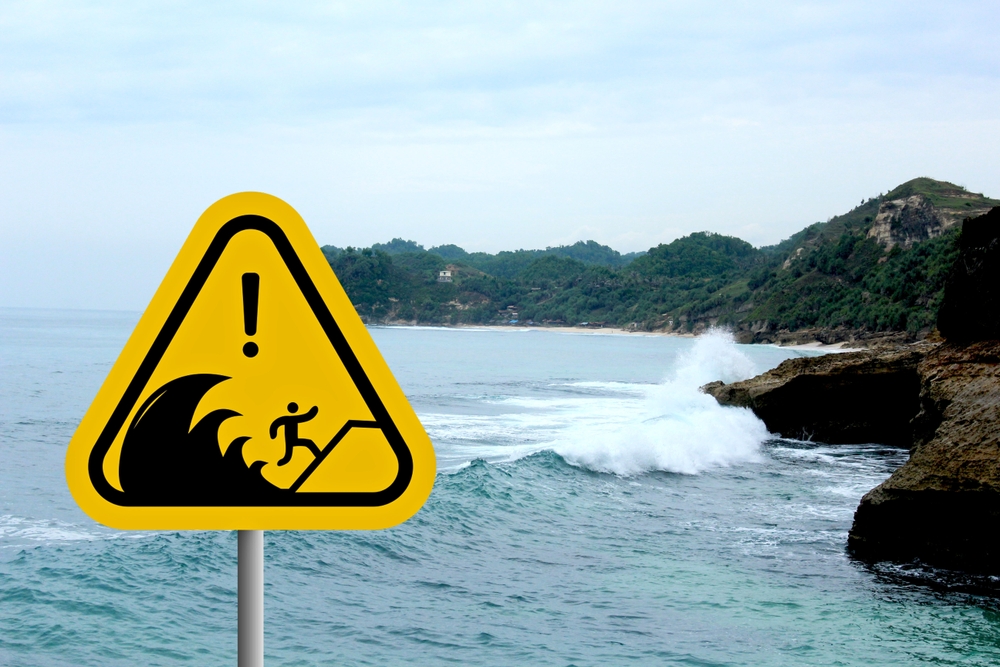

Tsunamis don’t look the way we picture them. Most people, if they imagined one coming, would picture a towering wall of dark water. The reality is stranger and, in some ways, more terrifying: a relentless surge that doesn’t stop, that keeps pushing inland for minutes at a time, carrying everything in its path. By the time it looks dramatic, it’s already too late to run.
The history of tsunamis is, in large part, the history of humans being surprised. Again and again, across centuries and coastlines, the pattern repeats: the water pulls back, the seafloor is briefly exposed, people are caught off guard. What changes, over time, is how much warning we can give and how many people survive because of it. Sometimes the answer is: quite a lot. Sometimes it isn’t nearly enough.
The events below are the ones that defined what we know about these waves, from a remote Alaskan fjord that produced the tallest wave ever measured, to a December morning in 2004 that changed how the world prepares for disaster. Each one is its own story, but together they trace something bigger than any single event.
The Science Behind the Wave
Before the individual disasters, it helps to understand what a tsunami actually is, because almost everything intuitive about waves does not apply. A tsunami is capable of stretching for thousands of square kilometers across the ocean surface and traveling faster than 800 kilometers per hour. Out in the open ocean, you’d sail right over one without noticing it. In deep water, tsunami waves are typically only about one meter high, making their destructive potential entirely concealed until the seafloor starts to rise beneath them.
It’s the shallowing of water near a coast that does it. The wave slows down, but the energy has nowhere to go except up. It is only when waves reach shallower depths near coastlines that they slow and can begin to grow, and while most tsunamis cause the sea to rise only about ten feet, some waves can reach as high as a skyscraper. That gap between the average and the extreme is where most of recorded history lives.
Because of the seismic and volcanic activity associated with tectonic plate boundaries along the Pacific Ring of Fire, tsunamis occur most frequently in the Pacific Ocean, but they are a worldwide natural phenomenon. They are possible wherever large bodies of water are found, including inland lakes, where they can be caused by landslides and glacier calving. The warning signs are often there, if you know what to look for. Recognizing them can be the difference between life and death, which is why natural disaster warning signs are worth understanding before you ever need them.
The Largest Wave Ever Recorded: Lituya Bay, Alaska, 1958
If you’ve never heard of the 1958 Lituya Bay tsunami, that’s partly because the location is so remote that the scale of it barely registered in the news at the time. According to Interesting Engineering, the Lituya Bay tsunami is by far the largest megatsunami ever recorded in history, yet most people have never heard of it, because it happened along the mostly uninhabited coastline of southeastern Alaska in a small fjord.
The Lituya Bay tsunami occurred on July 9, 1958, when an earthquake struck the Alaskan panhandle along the Fairweather fault line. This 7.8-magnitude earthquake shook loose a huge chunk of rock above Lituya Bay, causing nearly 40 million cubic yards of the mountainside to crash into the water. The wave rose 1,720 feet above sea level, altering the landscape around the entirety of the icy bay. To put that number in perspective: the Eiffel Tower stands 1,083 feet tall.
The wave destroyed millions of trees in its wake, the effects of which can still be seen today. Remarkably, given that scale, casualties were minimal. One family on a boat in the bay was lifted skyward, completely snapping their 73-foot anchor line, and was swept above the tree line, but somehow they surfed the wave to safety. Only five people died in total. The geography of the bay – essentially an isolated fjord with almost no settled coastline – kept what would otherwise have been a catastrophic death toll from materializing.
The Lituya Bay megatsunami holds its record not because of an undersea earthquake far out at sea but because of a landslide into a confined body of water. That mechanism, mass moving into water rather than the seafloor shifting beneath it, produces waves of an entirely different order. The physics are more like dropping a boulder into a bathtub than what we normally associate with tsunamis.
The First Global Tsunami: Chile, 1960
If Lituya Bay represents the largest wave, the 1960 Chilean earthquake produced the most geographically expansive tsunami in recorded history. The shaking on May 22, 1960 was the beginning of a magnitude 9.5 earthquake, the largest ever measured. It didn’t just rattle southern Chile. This earthquake generated a tsunami that traveled through every ocean on Earth, though large, dangerous waves only impacted coastlines around the Pacific Ocean.
Chile suffered the greatest impact, with tsunami waves reaching as high as 25 meters, or 82 feet, killing an estimated 2,000 people there. But what made this event so consequential was what happened next, to people who weren’t even aware that the largest earthquake in human history had just occurred. The tsunami reached Hilo, Hawaii, approximately 15 hours after the earthquake, with waves up to 10.7 meters high, resulting in 61 deaths and significant property damage. In Japan, the tsunami arrived about 22 hours later, causing 138 deaths and destroying over 1,600 homes, particularly in the Sanriku region.
The Chilean government estimated that nearly two million people became homeless and over 58,000 houses were completely destroyed. The broader death toll across all affected nations came to over 2,200 people, according to NOAA’s National Centers for Environmental Information. The global extent of this tsunami led to the creation of the Pacific Tsunami Warning and Mitigation System in 1965. Before 1960, there was no coordinated international system for alerting distant coastlines. After it, the framework that still operates today began to take shape.
The Deadliest Tsunami in Recorded History: Indian Ocean, 2004
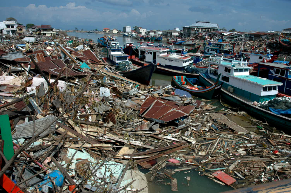
No event in modern history illustrates the gap between scientific understanding and real-world preparedness more starkly than the Indian Ocean tsunami of December 26, 2004. On that morning, an extremely powerful earthquake occurred off the coast of the Indonesian island of Sumatra. This magnitude 9.1 earthquake, the third largest in the world since 1900, generated a tsunami that reached as high as 167 feet and caused flooding up to three miles inland.
The deadliest tsunami in recorded history killed almost 230,000 people in fourteen countries, including Indonesia, Sri Lanka, India, Thailand, Somalia, Myanmar, Maldives, Malaysia, Tanzania, Seychelles, Bangladesh, South Africa, Yemen, and Kenya. The destruction was not evenly distributed. Some areas were obliterated. Others, where the geometry of the coastline deflected the wave or where there was higher ground close by, survived relatively intact. At the time, there was a lack of any robust warning system in the worst-affected areas. And many people in this part of the world simply had no way of knowing what a tsunami actually was.
That last point keeps coming back. In some places, people walked toward the receding water to look at the exposed sand and the stranded fish. The wave arrived minutes later. The disaster exposed the absence of a regional early-warning system, and in its aftermath, the Indian Ocean Tsunami Warning System was created, improving international coordination and ocean monitoring. The system became active in late June 2006 and consists of 25 seismographic stations relaying information to 26 national tsunami information centers, as well as six deep-ocean assessment buoys.
The 2004 event was not the tallest wave. It wasn’t even close to Lituya Bay’s record. But its death toll, concentrated in densely populated coastal areas across an ocean basin with no meaningful warning infrastructure, made it something qualitatively different. The deadliness of a disaster is never just about the disaster itself.
The Most Costly Tsunami: Japan, 2011
If 2004 showed what happens in the absence of warning systems, 2011 showed what happens when warning systems work and the wave comes anyway. On March 11, 2011, a magnitude 9.1 earthquake off the east coast of Japan generated a tsunami that caused tremendous devastation locally and was observed throughout the Pacific. According to the Wikipedia entry on the 2011 Tōhoku earthquake and tsunami, the earthquake was the largest ever recorded in Japan and among the most powerful in the world since record-keeping began.
The tsunami reached as high as 127 feet and traveled up to five miles inland. Towns that had seawalls built specifically for tsunami protection were overtopped. The earthquake and tsunami caused more than 18,000 deaths in Japan and an economic cost that the World Bank estimated could reach $235 billion, making it the costliest natural disaster in world history. Most of the deaths and damage were due to the tsunami, which also displaced more than 500,000 people and triggered a nuclear power plant accident.
The Fukushima Daiichi nuclear disaster added a dimension no other tsunami in history had brought: a slow-motion secondary catastrophe that unfolded over months and years, contaminating groundwater, displacing entire communities permanently, and reshaping global energy policy debates. The wave itself was gone in minutes. Its consequences weren’t.
What Japan demonstrated was both the effectiveness and the limits of preparation. For locations outside Japan, timely warnings and a large distance from the tsunami’s source gave communities more time for evacuations. Across the Pacific, Hawaii and the US West Coast had hours of warning and absorbed the wave with minimal casualties. But for communities within forty miles of the epicenter, no system issues a warning fast enough. The wave travels faster than any evacuation route.
The Quiet Reckoning
The story of humanity and tsunamis is, at its core, a story about learning from catastrophe in real time, and about the uncomfortable fact that the learning always comes after the loss. Destructive tsunamis are not unusual: they occur at a frequency of almost one per year. Most cause localized damage. A handful, in the right geographic and demographic conditions, turn into defining moments in history.
The 2004 Indian Ocean tsunami killed more than 200,000 people not simply because of its magnitude, but because of a specific combination: a densely populated coastline, zero warning infrastructure, and a region where tsunamis hadn’t struck in roughly 500 years, meaning no living memory held any instinct for what to do. The 1958 Lituya Bay wave was almost incomprehensibly larger and killed five people. The difference was the presence, or absence, of human beings in the path.
That intersection of geology and population density is where the real risk concentrates. Urbanization makes coastal communities more vulnerable, as megacities increasingly concentrate populations along fault lines and shorelines with each passing decade. The physics of tsunamis haven’t changed. The human exposure to them has.
The Pacific Tsunami Warning System, built after 1960. The Indian Ocean Tsunami Warning System, built after 2004. Both are genuinely important achievements, representing international coordination of a kind that doesn’t come easily. The systems work. People survive because of them who would otherwise not.
But warning systems tell you a wave is coming. They can’t move you out of its path, or make you trust the alert, or convince a whole coastal community to evacuate in thirty minutes in the middle of the night. The engineering problem has a solution. The human one is harder. What the history of tsunamis actually teaches, if you read it honestly, is that the gap between knowing and doing has been the most consistent source of preventable death across every event in the record. The wave is the wave. What changes is everything that happens before it arrives.
AI Disclaimer: This article was created with the assistance of AI tools and reviewed by a human editor.