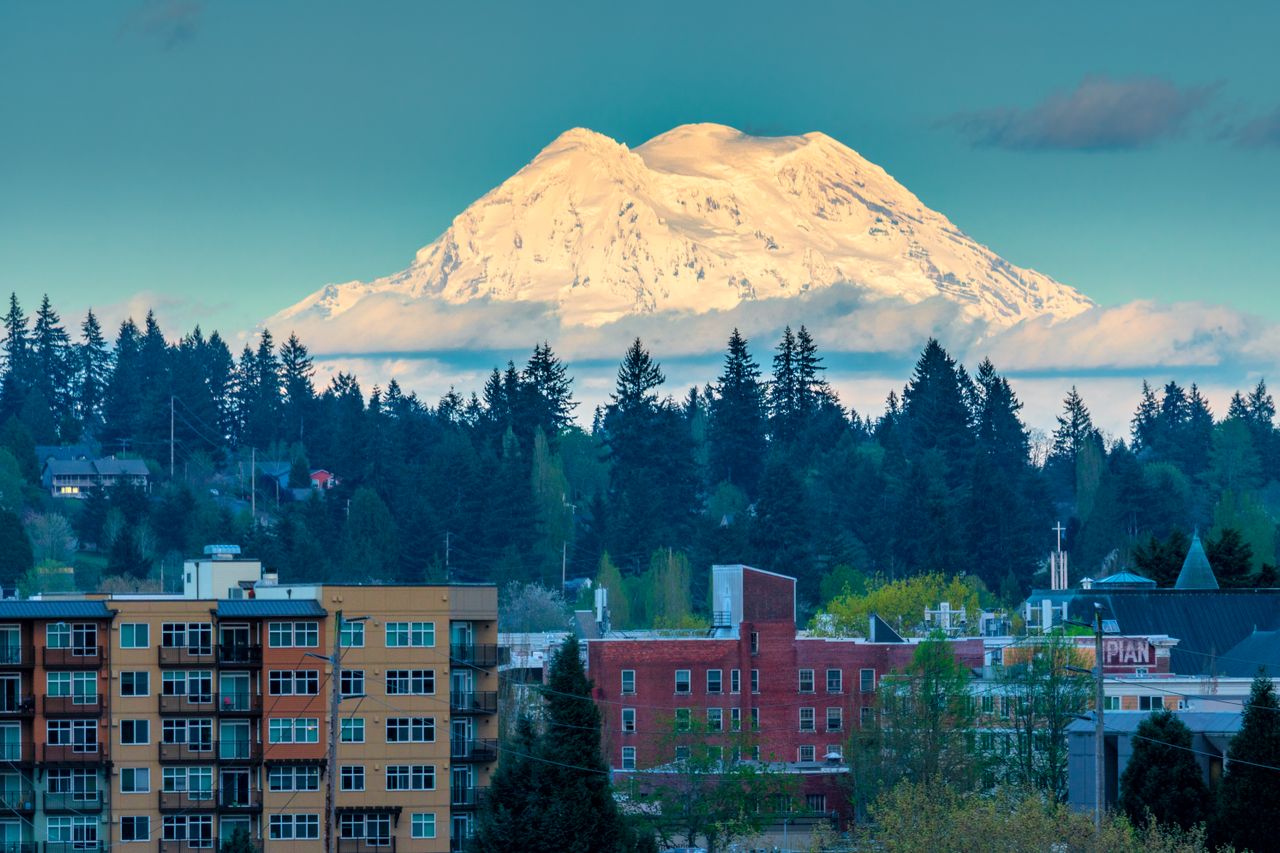

Sixty miles south of Seattle, there is a mountain that millions of people drive past, hike on, and photograph every year without giving much thought to what’s happening beneath it. Mount Rainier looks serene. Glacier-capped, impossibly photogenic, the kind of landmark that ends up on postcards and license plates. But volcanologists have been watching it closely for decades, and what they see is a volcano that carries one of the most serious threat profiles of any peak in the entire country – not because of the lava it might one day send down its slopes, but because of the water.
The real danger at Rainier isn’t fire. It’s a phenomenon called a lahar: a fast-moving torrent of volcanic debris, rock, glacial meltwater, and mud that can travel at the speed of a highway car and arrive in densely populated communities with virtually no warning. Scientists have studied this scenario in fine detail. The towns downstream have evacuation routes and warning sirens. Schoolchildren practice drills. And yet the underlying truth hasn’t changed: this is the most dangerous volcano in America, sitting within reach of millions of people, and the question scientists keep returning to isn’t whether a major event will happen – it’s when.
A record-breaking earthquake swarm in the summer of 2025 reminded the region, and the country, that Rainier is very much awake.
America’s Most Dangerous Volcano and Why Scientists Say So
Because of its elevation of 4,392 meters, its hydrothermal alteration, its massive icecap, glacier-fed radial valleys, and its proximity to the encroaching suburbs of the Seattle-Tacoma metropolis, the U.S. Geological Survey classifies Mount Rainier as the most threatening volcano in the Cascades. That designation carries weight. There are 161 potentially active volcanoes in the United States, and according to a 2018 USGS assessment, 57 of them are classified as a high threat or very high threat to public safety. Rainier sits at the top of that list.
The USGS National Volcano Early Warning System rates Mount Rainier’s threat potential as “Very High” – the agency’s highest classification. Due to its high probability of eruption in the near future and its proximity to a major urban area, Mount Rainier is also considered one of the most dangerous volcanoes in the world, and it sits on the Decade Volcano list – a designation given to the 16 volcanoes globally considered most likely to cause catastrophic loss of life and property.
At 14,410 feet, it is the highest mountain in Washington State, the most topographically prominent peak in the contiguous United States, and the tallest in the Cascade Volcanic Arc. The last magmatic eruption was about 1,000 years ago. Its most recent activity was in 1894 to 1895, when small summit explosions were reported by observers in Seattle and Tacoma. The dormancy is long. But dormancy is not the same as safety.
The Lahar Threat: Why Mud Is Deadlier Than Lava
Most people’s mental image of a volcanic disaster involves lava. Rainier would not work that way. Mount Rainier has 25 major glaciers containing more than five times as much snow and ice as all the other Cascade volcanoes combined, and if only a small part of that ice were melted by volcanic activity, it would yield enough water to trigger enormous lahars. A lahar – the word comes from Javanese – is essentially a volcanic debris flow: a dense slurry of water, pulverized rock, volcanic ash, and anything else in its path, behaving less like a river and more like wet concrete in motion.
Past lahars from Mount Rainier are estimated to have traveled at 45 to 50 miles per hour where confined in the valleys near the volcano, and slowed to between 15 and 25 miles per hour in the wider downstream valleys. Scientists estimate that debris flows can travel the distance between Mount Rainier and the Puget Sound lowland in as little as 30 minutes to a few hours. That is not much time. The town of Orting, Washington – population roughly 10,000, built directly on old lahar deposits in the Puyallup River Valley – sits about 20 miles from the summit. When scientists model a major lahar event, Orting has somewhere between 30 and 60 minutes before the flow arrives.
At Mount Rainier, the risk from lahars is greater than from lava flows, volcanic ash fall, or other volcanic phenomena because some of the pathways for future lahars are densely populated and contain critical infrastructure including highways, bridges, ports, and pipelines.
Giant debris flows sometimes develop when large masses of weak, water-saturated rock slide from the volcano’s flanks – and many of these flows cannot be predicted and may even occur independently of any volcanic eruption. That last point is the part that keeps scientists up at night. A lahar doesn’t require an eruption to start. A large landslide on an already-weakened mountainside can do it. Studies by USGS scientists show that at least one of Mount Rainier’s recent large landslide-generated lahars may have occurred when the volcano was dormant and not providing the usual warning signs of an erupting volcano – meaning the only warning in such a rare case could be a report that a lahar is already underway.
The Population at Risk and the Historic Record
A 2015 USGS study determined that over 90,000 people live in Mount Rainier lahar hazard zones, along with over 50,000 employees working in approximately 3,800 businesses. According to the USGS, about 150,000 people live on top of old lahar deposits from Rainier. Towns including Orting, Sumner, Puyallup, and Fife lie in direct lahar paths.
The historical record shows this is not a theoretical risk. Around 5,000 years ago, a large chunk of the volcano slid away, producing the massive Osceola Mudflow, which traveled all the way to the site of present-day Tacoma and south Seattle – an avalanche of rock and ice that removed the top 1,600 feet of Rainier. The flat floor of the Puyallup River Valley near Orting is formed by deposits of the 500-year-old Electron lahar, which surged down from Mount Rainier. People are living on the evidence of past catastrophes without always realizing it.
If future large lahars happen at rates similar to those of the past, there is roughly a 1-in-10 chance of a lahar reaching the Puget Sound lowland during an average human lifespan. The USGS has separately estimated there is a one-in-seven chance of a catastrophic lahar at Mount Rainier occurring in the next 75 years.
The Colombia comparison is the one scientists cite to illustrate the stakes. In 1985, the city of Armero, Colombia, was battered by lahars generated by an eruption of the glacier-clad Nevado del Ruiz volcano. More than 20,000 people died. If Mount Rainier were to erupt as powerfully as Mount St. Helens did on May 18, 1980, the cumulative effect would be far greater, because of Rainier’s vastly larger quantities of glacial ice, the more heavily populated surrounding areas, and the fact that Rainier is almost twice the size of St. Helens.
The 2025 Earthquake Swarm: A Wake-Up Call
In the summer of 2025, something happened beneath the mountain that broke records and renewed national attention on the dangerous volcano America has largely taken for granted. An earthquake swarm that started at Mount Rainier on July 8, 2025 – beginning at 1:29 a.m. PDT – is the largest ever recorded at the volcano. The Pacific Northwest Seismic Network located approximately 1,350 earthquakes by late August, with the earthquake rate peaking at 41 located events per hour on the morning of July 8 before gradually decaying to less than one located event per day by late August.
According to Pacific Northwest Seismic Network director Harold Tobin, this was the “most energetic swarm” ever recorded at Mount Rainier, though at the time there was no sign of unusual magma activity. The last large swarm at Mount Rainier before this occurred in 2009, had a maximum magnitude of 2.5, and lasted three days. The 2025 swarm surpassed that event in total number of events, event rate, and energy release.
Despite the elevated seismic activity, the USGS Cascades Volcano Observatory found no sign of magma movement or volcanic unrest, instead concluding that the swarm was triggered by underground fluids shifting through cracks deep below the mountain. In technical terms, that means the hydrothermal system – the network of superheated water and gases circulating within the volcano’s core – was adjusting, not the magma chamber itself. The Volcano Alert Level and Aviation Color Code for Mount Rainier remained at NORMAL/GREEN throughout the swarm, as the activity was related to the volcano’s hydrothermal system.
That context matters but doesn’t entirely reassure. The swarm was a reminder that Rainier is not still. It is active, restless, and monitored for good reason.
The Structural Weakness No One Talks About
Beyond the glaciers and the lahar pathways, there is a slower-moving threat baked into the mountain’s geology. Extensive hydrothermal alteration of the upper portion of the volcano has contributed to its structural weakness, and an active thermal system driven by magma deep under the volcano has melted out a labyrinth of steam caves beneath the summit icecap.
Hydrothermal alteration is the process by which acidic, sulfur-rich water and steam chemically rot the rock from the inside. Over centuries, this turns solid volcanic rock into weak, clay-like material that can fail suddenly under its own weight. The greatest hazard from lahars generated by landslides is concentrated on the west side of the volcano, because it contains the largest amount of hydrothermally weakened rock. The combination of weak, hydrothermally altered rocks, large quantities of snow and ice, and a seismically active volcano makes landslides and rockfalls ongoing potential hazards at Mount Rainier.
This is the scenario that doesn’t require an eruption trigger. A large enough earthquake, a sufficiently warm summer accelerating glacial melt, or even the slow accumulation of internal rock decay could destabilize the western flank – and send hundreds of millions of cubic meters of material toward the valley floor below.
The Warning System and What It Can – and Can’t – Do
Washington State has not been passive about this. The Mount Rainier Volcano Lahar Warning System uses a network of small sensors called Acoustic Flow Monitors (AFMs) embedded underground to measure ground vibrations produced by passing lahars. Upon detection of a lahar, the computer alerts local 24-hour emergency monitoring and notification centers, who initiate the warning component of the system – triggering immediate, preplanned emergency-response actions.
Over 40 Federal Signal Modulator sirens are strategically placed throughout the Puyallup River Valley. In March 2024, 45,000 students participated in what was described as the world’s largest lahar evacuation drill. Tens of thousands of people live in areas that may have as little as 40 minutes to as much as three hours to reach safety once a large lahar is detected – which is why the system aims to be robust, warnings are disseminated promptly and widely, and communities are trained in how to respond.
But the warning system has a critical gap. It detects a lahar once it’s already moving. If the triggering event is a landslide rather than an eruption, there will be no volcanic unrest to flag in advance. USGS scientists studying Mount Rainier and its hazards for over 70 years have long recognized that the greatest danger may not be a volcanic eruption, but instead large mudflows called lahars. Getting people off the valley floor and to higher ground is the only proven survival strategy – and in a middle-of-the-night scenario, with traffic, limited road capacity, and a 30-to-60-minute window, that calculation is uncomfortably tight.
Experts believe a Mount Rainier eruption would pose a grave threat to millions who live in the southern and eastern sections of the Seattle metropolitan area. The lahar risk is concentrated in the river valleys, but the secondary impacts – disrupted transport, destroyed infrastructure, compromised water supplies, and ash fallout – would radiate far beyond the immediate inundation zones.
Read More: 9 Travel Spots Where the Extreme Weather Is More Dangerous Than the Wildlife
What to Do With All of This
Mount Rainier is not a dormant backdrop. It is an active stratovolcano carrying the highest volcanic threat designation in the United States, positioned within reach of one of the country’s major metropolitan regions. The threat is not primarily lava – it is lahars, fast-moving debris flows capable of burying entire communities under meters of mud and rock in under an hour.
The population exposure is staggering. Over 90,000 people live inside formally designated lahar hazard zones. Around 150,000 people have settled on top of geological deposits left by past flows. The towns of Orting, Puyallup, Sumner, and Fife sit directly in the mapped inundation paths. The statistical probability of a major lahar reaching the Puget Sound lowland within the span of a human lifetime sits at roughly one in ten – and the volcano’s internal geology means that event could be triggered without any eruption, and with very little advance warning.
The 2025 earthquake swarm – the largest ever recorded at Rainier, comprising over 1,350 located earthquakes in roughly seven weeks – produced no magma movement and no change in alert level. Scientists attributed it to hydrothermal fluid movement within the volcano. The swarm did not signal an imminent eruption. But it was a vivid demonstration that the mountain is not still, and that the monitoring infrastructure exists precisely because events can escalate faster than institutions can respond.
The warning systems in place are serious and sophisticated. Evacuation drills are real. Community preparedness has improved measurably over the past two decades. But the underlying physics of the hazard hasn’t changed, and neither has the fundamental constraint: for some communities downstream, the window between warning and impact may be shorter than the time it takes to get everyone in a car and onto a road out of town.
For the roughly 150,000 people living on the old lahar deposits of Mount Rainier, awareness of the hazard zone they’re in, registration for local emergency alerts, and a practiced evacuation plan are not abstract precautions. They are the practical difference the warning system is designed to serve – if and when the mountain decides to remind everyone it’s still there. The uncomfortable truth is that the science has been clear for decades. The communities are built. The people are there. And the mountain hasn’t changed its mind about any of it.
Disclaimer: This information is not intended to be a substitute for professional medical advice, diagnosis, or treatment and is for information only. Always seek the advice of your physician or another qualified health provider with any questions about your medical condition and/or current medication. Do not disregard professional medical advice or delay seeking advice or treatment because of something you have read here.
AI Disclaimer: This article was created with the assistance of AI tools and reviewed by a human editor.