
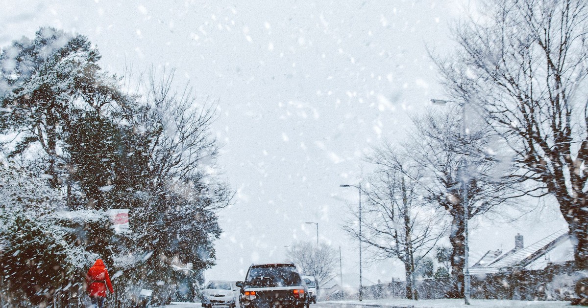
The forecast for a typical week in Kansas City in May reads like a weather sampler platter: thunderstorms Monday, tornado watch Wednesday, sunny and 85 degrees by Friday. Midwesterners glance at it the way someone in Oslo checks their rain app – it’s just what it is. But show that forecast to someone from, say, the Netherlands or Japan, and they would find it genuinely alarming.
American weather patterns operate at a scale and intensity that most of the rest of the world simply doesn’t encounter. Not occasionally. Structurally. The geography, the atmospheric layout, and the collision of air masses that define this country’s weather are, in important ways, one-of-a-kind on Earth. Other places get storms. Other places get heat. But no other country routinely experiences all of it, at this intensity, from coast to coast, in the same calendar year.
What follows isn’t a disaster countdown or a tour of the most extreme events on record. It’s an attempt to make visible what Americans have come to treat as baseline – the kind of weather that gets a shrug from a Texan but would make international headlines somewhere else.
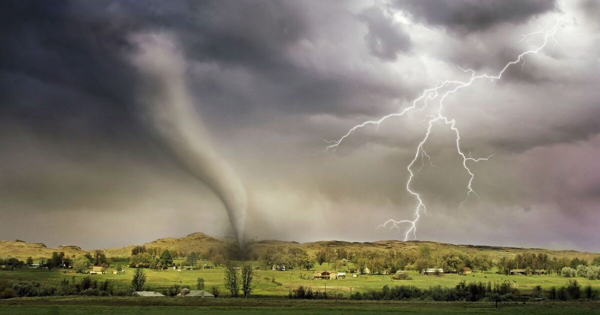
A Country That Gets 1,200 Tornadoes a Year
Start with the number: about 1,200 tornadoes hit the U.S. yearly. Now consider that Tornado Alley – the broad swath of the central U.S. that sees the highest concentration – gets at least ten times more tornadoes than the rest of the world combined. The United States has the most tornadoes of any country, as well as the strongest and most violent.
The central part of North America creates near-ideal conditions for severe storms. Warm, moist air flows north from the Gulf of Mexico while cooler air masses sweep south from Canada across the plains states and Midwest. The Rocky Mountains to the west and the flat, open terrain of the Great Plains are what seal the deal: there’s no natural barrier to stop the two air masses from colliding with maximum force. The result is supercell thunderstorms – rotating, towering storm systems capable of producing tornadoes, baseball-sized hail, and destructive straight-line winds in the same afternoon.
Tornadoes have been recorded on all continents except Antarctica. They’re most common in the middle latitudes where conditions favor convective storm development. So Europe gets them. South America gets them. But Europe experiences around one-fourth as many tornadoes as the U.S., most of which are too small to cause damage. South America has its own tornado corridor, largely confined to the grasslands of Argentina and portions of Uruguay, Paraguay, and Brazil, and while it technically averages about 1,000 twisters a year, its tornadoes don’t produce equivalent damage and are likely undercounted.
What’s shifting now is where in the U.S. those tornadoes land. Research suggests that the main alley may be shifting eastward away from the Great Plains. Experts say the data indicates Tornado Alley is moving east, with more activity occurring in the belt between Louisiana and Illinois – a region with higher population density, older housing stock, and fewer storm shelters than the traditional Plains states. Despite the elevated frequency of destructive tornadoes, building codes in tornado-prone areas are not necessarily stricter compared to other parts of the United States and are markedly weaker than some hurricane-prone areas like south Florida.
The Hurricane Season Is Its Own Annual Institution
The average number of tropical storms and hurricanes per year for the decade from 2015 to 2024 was 18 – the highest 10-year average on record, based on NOAA data going back to 1851. Somewhere along the way, Americans started treating June through November as a second calendar, a parallel season of named storms tracked on maps pinned to kitchen walls. Evacuations from Florida to the Carolinas are treated as something you plan around, the way you plan around school holidays.
Of all the billion-dollar disasters affecting the U.S. from 1980 to 2024, tropical cyclones are the most costly. At more than $1.5 trillion, they account for 53% of all billion-dollar disaster costs across that entire period. The 2024 season alone demonstrated what that looks like in real time: record-to-near-record sea surface temperatures in the Atlantic basin helped fuel an active season that formed 18 named tropical systems, eleven of which were hurricanes, including two Category 5 storms.
The 2025 season that followed played out differently but no less dramatically. While the climatological peak of the season was unusually inactive, the season generated three Category 5 hurricanes – the second-most in a single season on record. The basin produced a near-average number of named storms and a below-average count of hurricanes, but among them was Hurricane Melissa, described as the most intense landfalling cyclone ever observed in the Atlantic basin during modern times.
No other ocean basin produces this combination of frequency, intensity, and proximity to a densely populated coastline on quite the same terms. The Atlantic’s particular mix of warm water, low wind shear during active periods, and geography that funnels storms directly toward the southeastern U.S. is a combination that other regions – including the Pacific – don’t replicate consistently.
A Billion Dollars at a Time, Constantly
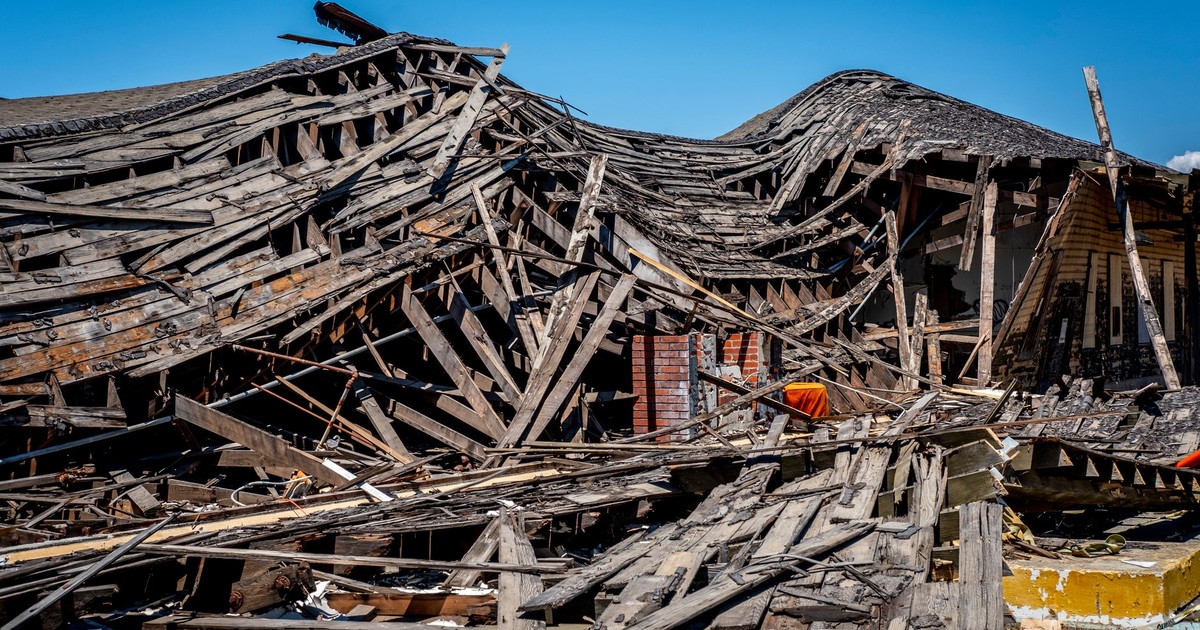
During 2024, the U.S. experienced 27 weather and climate disasters each incurring losses that exceeded $1 billion. The total cost for these disasters in 2024 was $182.7 billion. That’s a number so large it becomes abstract – until you put it against the historical baseline. The 1980 to 2024 annual average was 9.0 billion-dollar events; the annual average for the most recent five years, from 2020 to 2024, is 23.0 events.
2024 was a record 14th consecutive year where the U.S. experienced 10 or more billion-dollar disasters and the fifth consecutive year (2020-2024) where 18 or more such disasters impacted the country. There are not many countries in the world where “10 or more $1 billion disasters per year, every year for 14 straight years” is a streak that can even be built. The U.S. has the geography, the storm types, and the built environment exposed to those storms that makes this possible. The safest U.S. places increasingly factor in weather risk alongside other variables, precisely because no region of the country sits outside the reach of at least one of these recurring threats.
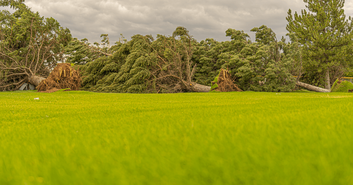
Severe storms – thunderstorms that produce tornadoes, damaging winds, or large hail – are the most frequent category. The 203 billion-dollar severe storm events since 1980 account for half of all billion-dollar disasters on record. That category doesn’t grab the same headlines as a major hurricane, but it’s the one running up the tab year after year in the farm country, the suburbs of Dallas, and the river valleys of the Ohio Valley.
The Polar Vortex and the Heat Dome
Two terms that entered common American vocabulary in the last decade or so – “polar vortex” and “heat dome” – describe weather phenomena that the rest of the world also experiences, but rarely in the same way the U.S. does, in terms of their reach and intensity.
The polar vortex is a band of cold air that spins around the Arctic. Most of the time, it stays where it belongs. When it weakens or stretches, a lobe of it can plunge southward across the U.S., sending temperatures 20 to 35 degrees below normal into states as far south as Texas. January 2025 was the coldest January in much of North America in at least 10 years, bringing temperatures as much as 20-35°F below average to a majority of the United States, starting from the polar vortex pushing south after the passage of an Arctic front. That same month, a historic winter storm hit the Gulf Coast, with Louisiana and Florida breaking their largest single-day snowfall records. Snow in Florida. It sounds like a punchline, but it happens.
Heat domes work in the opposite direction. A heat dome forms when a high-pressure system – a mass of air sinking from above – parks over a region and traps hot air near the surface. When a heat dome forms and parks over the Southwest, it can bake temperatures to triple digits that haven’t been seen that early in the year. The jet stream moves weather from west to east on a roller-coaster-like path – and right now that jet stream is barreling through near-vertical drops followed by sharp ascents. The practical result of that behavior is what meteorologists call “weather whiplash” – Washington, D.C., residents walked around in shorts in record-breaking 86°F heat on a Wednesday, and on Thursday it snowed.
Extreme temperature swings of that kind in a 24-hour window would be front-page news in most of Western Europe. In the U.S., it earns a segment on the local news before the sports update.
The Wildfire West
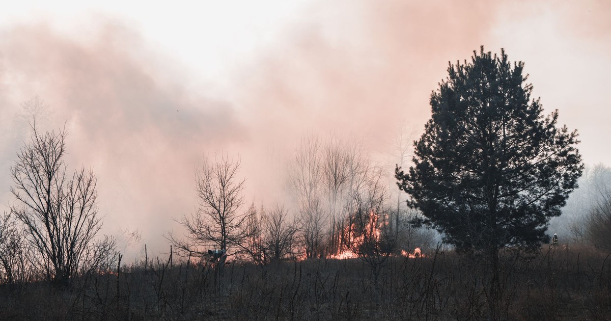
California’s relationship with wildfire is its own distinct chapter in American weather patterns. The combination of periodic drought, dry offshore winds called Santa Anas, and decades of development pushing into fire-prone terrain has created a fire season that now runs year-round in many parts of the state.
The January 2025 fires in Los Angeles illustrated exactly how quickly that combination can detonate. In a classic sequence, two wet years had led to abundant grasses and shrubs that then dried out in the months leading up to the fires. Virtually no rain had fallen over the area from May through December 2024, the second-driest such stretch in records going back to 1877. An unusually powerful wind-making setup arrived in early January, pushing fierce winds far deeper into the Los Angeles area than usual – and at least 31 people were killed in those fires. One study published in a 2025 JAMA letter estimated that the fires contributed to at least 440 deaths when the indirect toll – smoke inhalation, delayed emergency response – was accounted for.
No one in Los Angeles considers wildfires unusual anymore. The fires have names, evacuation routes, and air quality apps. Parents check the AQI before letting children play outside. That level of normalization, for what would constitute a national crisis anywhere else in the developed world, is one of the more striking things about American weather patterns today.
“Weather Whiplash” as a Way of Life
Nearly every part of the United States is getting hit by wild weather or is just about to be – that line, from a PBS News Hour report in March 2026, described a single week’s forecast. Not an annual summary. One week.
A changing climate reshapes complicated atmosphere and ocean patterns, sometimes introducing extraordinary weather outside of what people have experienced in the past. The deadly 2021 heat wave in the Pacific Northwest, for example, was demonstrably hotter because of climate change – but the atmospheric conditions that allowed it to occur in the first place were essentially unprecedented in the region. Portland, Oregon, hit 116°F that June. A city built for mild, cloudy summers. The people who died in that heat wave mostly didn’t own air conditioners, because they never needed them before.
The sizzling pace set nationally in recent years continued in 2025, when the contiguous 48 states experienced their fourth-hottest annual average temperature on record – 54.64°F for the year, placing it fourth behind 2024, 2012, and 2016. The 2025 average came in 2.63°F above the 20th-century average. Across 131 years of U.S. recordkeeping, the 10 warmest years are now packed into the last two decades, and nine of those years have occurred since 2011.
What This Actually Means
People do adapt to the weather they’re born into. They build storm cellars under their houses in Oklahoma. They track hurricanes the way other countries track football league tables. They move their outdoor plans around wildfire smoke. That adaptation is real, and it reflects something genuinely resilient about how communities organize themselves around what their geography demands.
But adaptation is not the same as normalcy. The rest of the world uses the U.S. as something close to a case study – a country where atmospheric conditions, geography, and climate make almost every category of severe weather simultaneously possible. The flat plains that let tornadoes build without obstruction, the Gulf of Mexico feeding moisture into supercell thunderstorms, the Atlantic basin’s particular warmth fueling hurricane after hurricane, the dry western terrain going years without meaningful rain and then burning. All of that is happening on one landmass, in one country, in the same year.
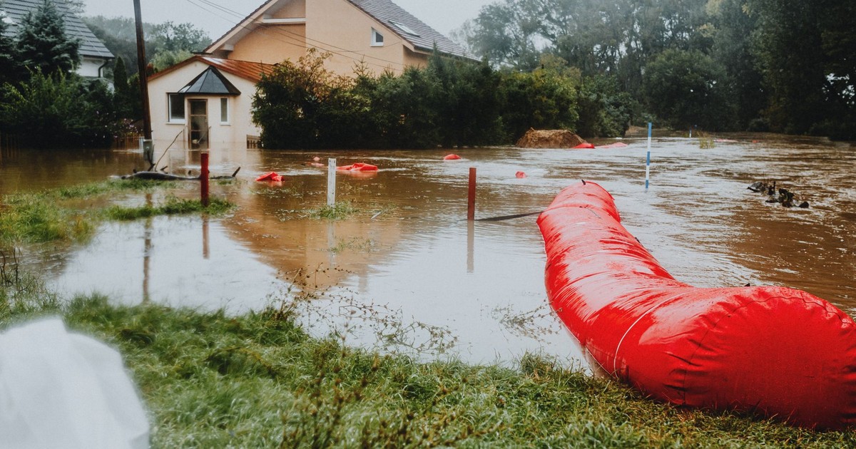
What’s actually changing is not just the frequency – it’s the geography of exposure. Tornado Alley is shifting east. Wildfires are burning in places they haven’t touched in recorded history. Flash floods are hitting inland communities that never built flood infrastructure because they never needed it. The people who will feel this most sharply are not the ones who’ve always known the risk. They’re the ones for whom a certain kind of weather was, until recently, someone else’s problem. That shift doesn’t announce itself – it arrives in the form of an insurance letter, a smoke advisory, a flood map redrawn to include a street that flooded once and never used to.
AI Disclaimer: This article was created with the assistance of AI tools and reviewed by a human editor.