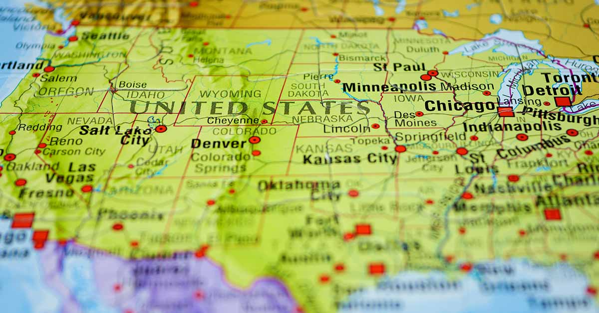

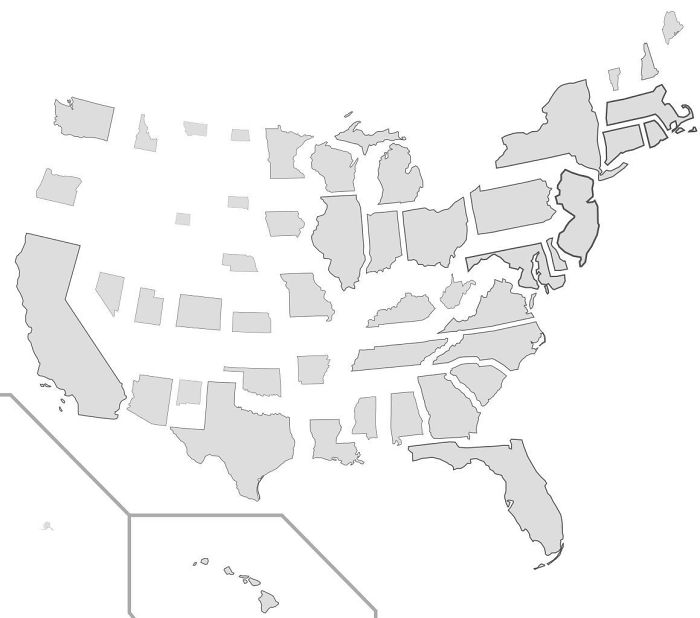
For every Internet user who starts fights about the USA using facts they pulled out of their back pocket, there is a map that shows facts about America as they are and lets people make up their own minds about what they mean. Because of things like light pollution, trees, railways, streets, and roads that aren’t in use, maps may not look as interesting at first glance as a viral cat video. This is one reason why we might miss them, but that doesn’t mean they’re dull. We’ve put together a list of lesser-known, but interesting facts about America.
1. Most Commonly Spoken Language
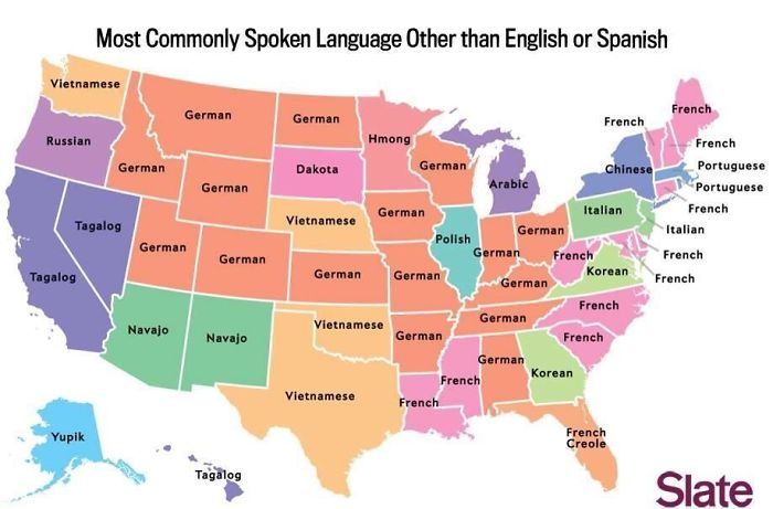
These are the languages that the states speak the most, after English and Spanish. However, take the map with a grain of salt since commenters on the Reddit post have pointed out quite a few inconsistencies and mistakes.
Read More: 40 Pics of Things You Don’t Often See
2. The Perspective Of A Brit
This is absolutely not an official map if the title is not clear enough. It’s actually a British Reddit user’s attempt at sharing how he looks at America, at a glance.
3. America From Alaska
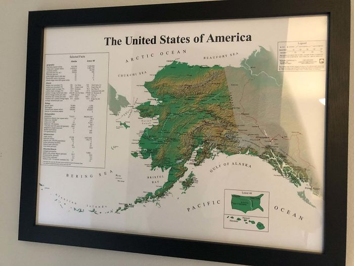
If this map of the USA looks extremely different from what you are used to, then you are correct. It is. Those with keen eyes may have already noticed that the usual map is in the bottom right corner. The bigger map is only a map of the state of Alaska.
4. States With Less People Than LA
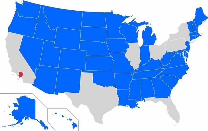
Los Angeles is marked in red. Every state that has a population smaller than LA is marked in blue. It might look surprising, but as a commenter points out: “Yeah, but to be fair, half of the US is basically uninhabited nothingness.“
5. Red And Orange Have Equal Population
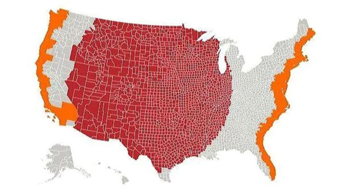
The total population in the area marked in red is equivalent to the total population in the area marked in orange. The coastal areas of the country are a lot better places to live in, apparently.
Read More: 30+ Most Dangerous Beaches In The World
6. US Watersheds
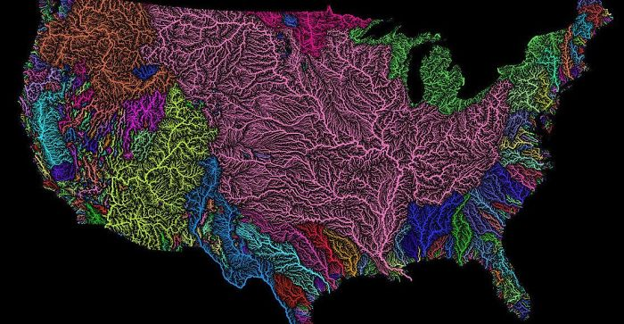
An explanation for watersheds from a commenter: “For those that don’t know, a watershed is a geologic area from which all water drains to the ocean. The pink area is the Mississippi River basin which includes the Missouri, Ohio, Platte, Allegheny, Red, and Arkansas rivers (among many, many others).”
7. Population Lines
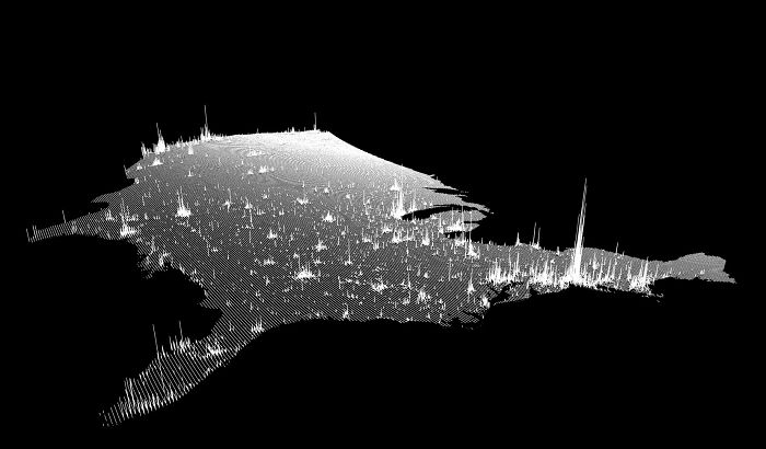
This map is a vertical representation of the population density in the United States of America. The taller the line, the higher the number of people living in that area.
8. Tree Cover in The US
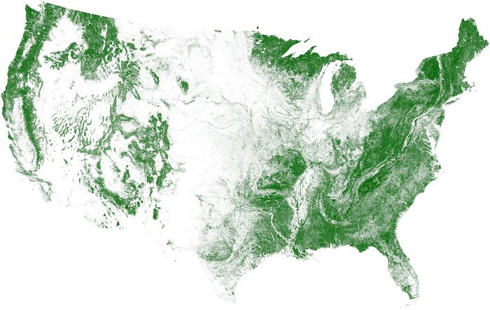
This map shows the density of trees in the United States. The middle of the country is quite barren compared to the coastal areas.
9. The Shortest Route Between Every Springfield
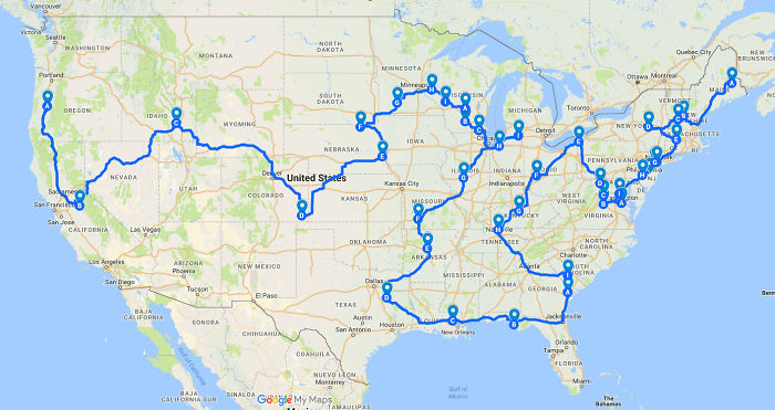
As is clear, there’s a lot more than one place called “Springfield” in the United States. This map shows the route that you can take to reach every one of them, fastest. For the record, the one in The Simpsons is believed to be in Oregon.
Read More: Widow Donates $1 Billion to Cover Tuition for NYC’s Poorest Area Forever
10. Snow Taken To Cancel School
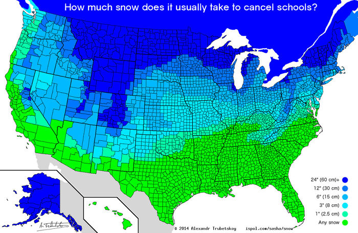
You would think that the entire country would have the same marker when it comes to how much snow is too much for school. However, that is not the case. Humans are quite adaptable to their living conditions, after all.
Read More: 37 Men Dressed In Their National Costumes for a Male Beauty Pageant
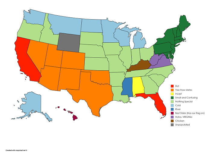
11. The Least Favorite State Of Every State
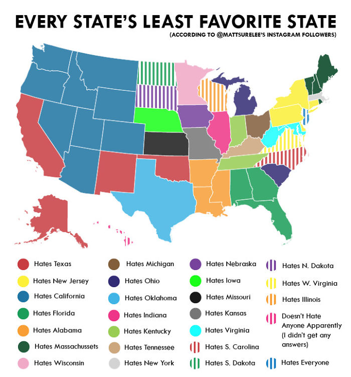
Quick disclaimer: this measure of hatred is only according to the OP’s followers on Instagram. Even then, it seems like California should perhaps work on being a bit more likable. Also, New Jersey is too sour.
12. Most Common Surname By State
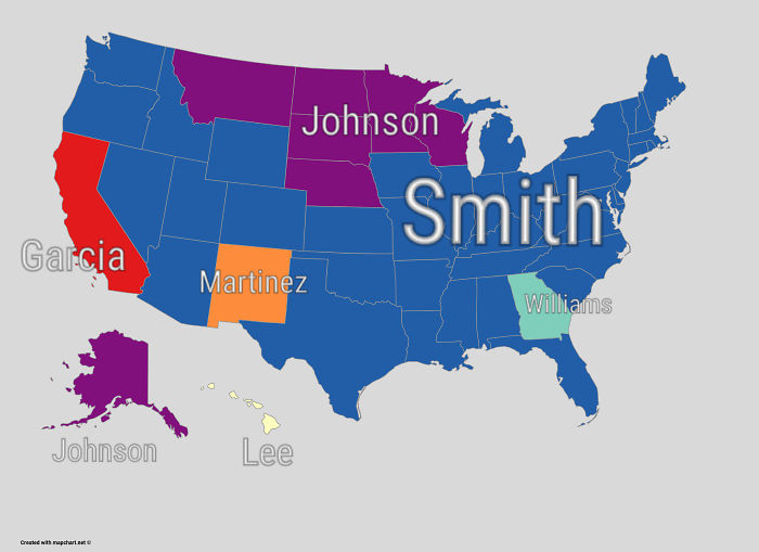
Statistically, Smith is also the most commonly used made-up name in the English language. Also, “Li” is the world’s second most common surname, followed by “Wang”.
13. Most Common Country Of Birth For Foreign-Born Residents
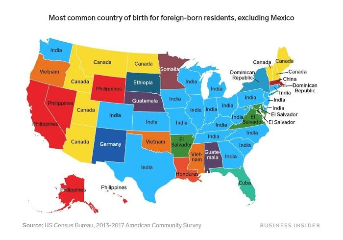
Another quick disclaimer: this map only shows the countries that are not Mexico because as many as 32 out of the 50 states would then be showing Mexico. As you can see, Indians make up a large portion of the population.
14. Deaths Due To Drug Overdoes (1999 vs 2014)
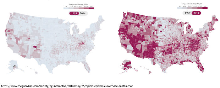
This map is a much more depressing statistic. The map shows how many people lost their lives per 100,000 due to drug overdose in 1999 (Left) and 2014 (Right). Unfortunately, the problem has skyrocketed.
15. Population Is More In Red Than Grey
Here is another map that shows the grossly uneven population distribution in the United States. The total population in the areas marked in red is higher than that in the areas marked in grey.
Read More: 10 Cars You’ve Probably Never Heard Of
16. States Scaled According To Population Density
Here, the size of the states has been scaled according to their relative population density in the United States. As you can see, Alaska (one of the largest states) is now one of the tiniest states.
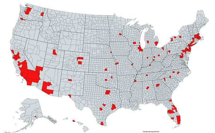
17. Out-of-service Railway Lines
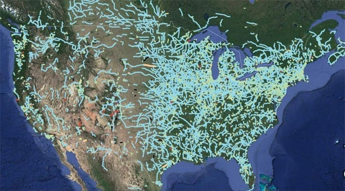
This is a look into the history of the country. These are all the railway lines that were once bustling with use but have now become obsolete and abandoned.
18. Quietest And Loudest Spots
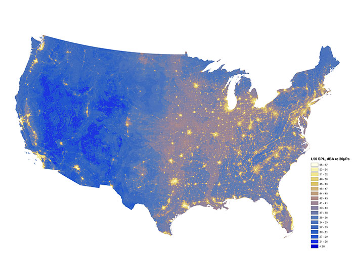
Ever wondered if your area is loud or silent compared to the rest of the country? Well, now you can see it represented on the map. The yellower it is, the louder it is.
19. Map of Desire to Move
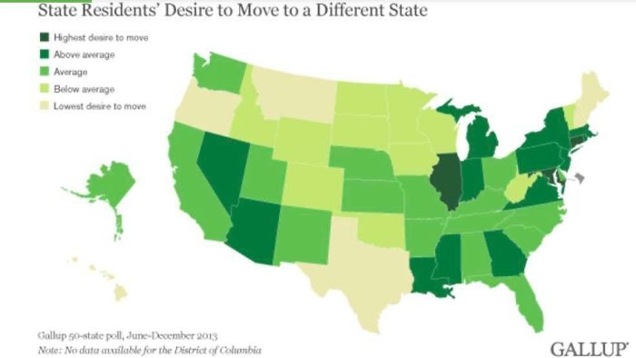
If you are living in any of the states that are dark green, and want to move, then you are not alone. On the other hand, for people in the light yellow states, you are not the norm if you have that desire.
20. Usage of Land
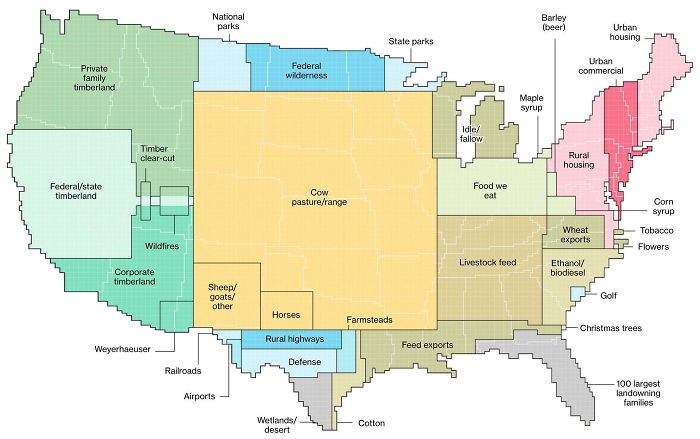
The central uninhabited expanses of the United States do not go to waste. They are primarily used for agriculture and forestry. This surprised many users on its original Reddit post.
Read More: 10 Historical Facts You Probably Haven’t Heard Of
21. Use of the word “Dang”
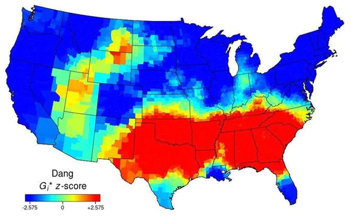
“Dang”. You may not be one of the people who use it, but here are the places where you will hear it the most. It’s usually in the Southern part of the country.
22. Percentage of People Who Are Not US-Born
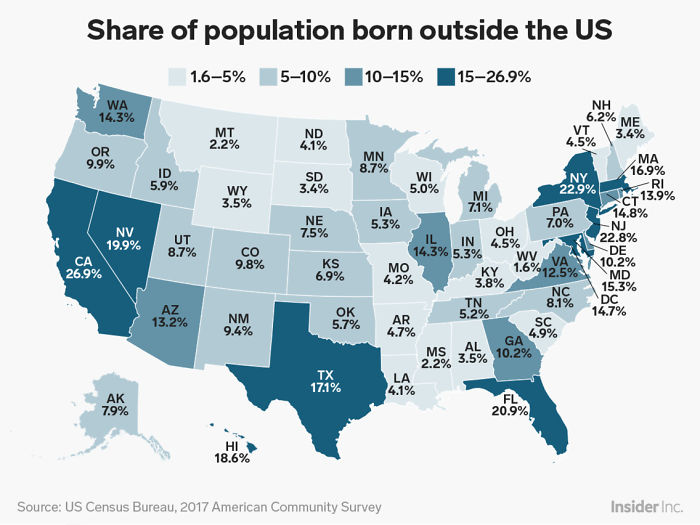
To those who are confused as to the real number of “outsiders” in the country – here they are. Not as much as you might be led to believe by some.
23. Most Popular Coffee Chain
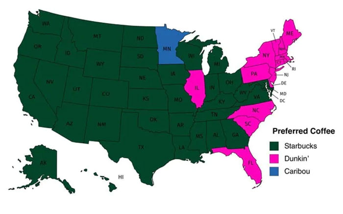
Do you like Starbucks or Dunkin’? Well, for the majority of the country, Starbucks is the go-to choice. However, for Minneapolis, it seems like Caribou has a special place.
24. Regions That Don’t Celebrate Christopher Columbus Day
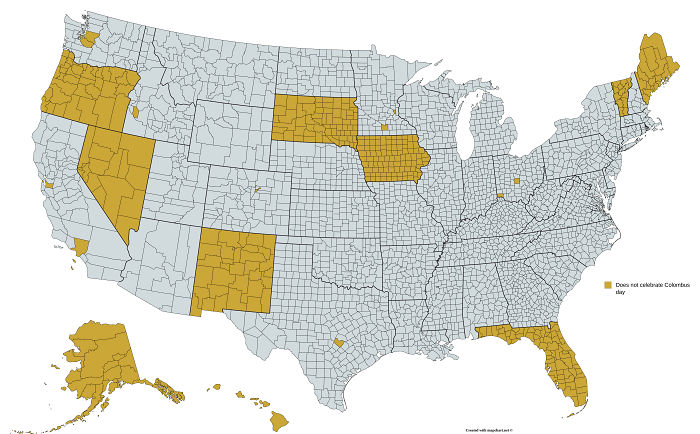
Christopher Columbus is accredited with “discovering” the American continent. However, his atrocities against the native inhabitants at the time are very controversial. These are the regions that do not officially celebrate Christopher Columbus Day.
25. Lowest Recorded Temperature
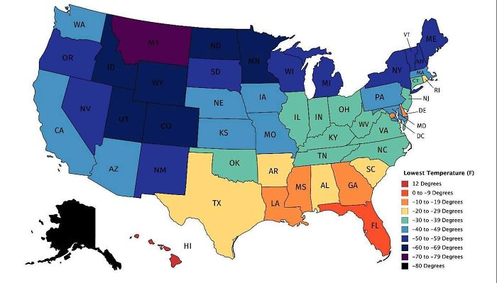
This map is a testament to the geographical vastness of the United States. These are the lowest recorded temperatures (in Fahrenheit) for every state. It goes from 12 degrees to as low as -80 degrees.
Read More: Oldest Mall In America Turned Into Tiny Homes
26. Air Traffic Control Zones
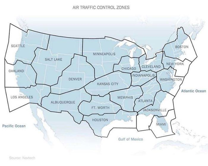
Air Traffic Control Zones do not overlap with state borders. These indicate which air traffic center an airplane should be in contact with, depending on the area they are flying in.
27. Light Pollution
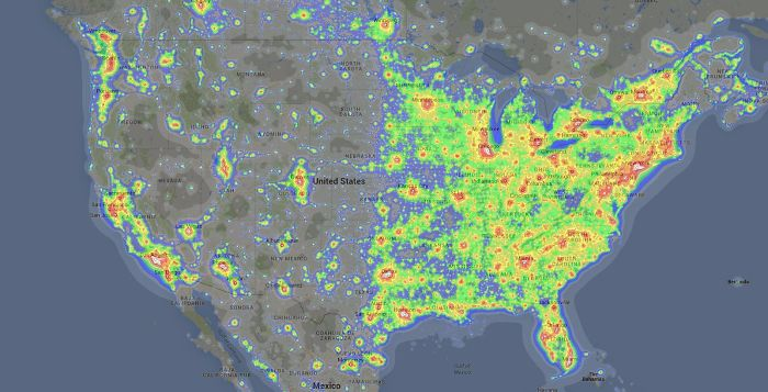
Interestingly enough, this map indicates that light pollution in one of the most developed countries in the world is kind of split down the middle. For any starwatchers, living on the left side would be much better.
28. Spending on Education
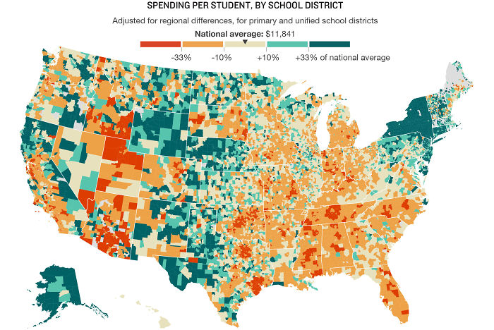
This map shows a rather interesting social aspect of one of the most powerful countries in the world. The redder the area, the less the State decided to allocate to education.
29. Tree Diversity
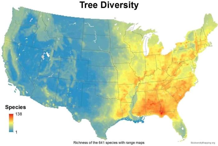
This map shows how many kinds of tree species are available in a region. As you can see, on the left side, there’s not a lot of variety. On the other hand, the number can go up to 138.
30. Roads, Streets, and Highways
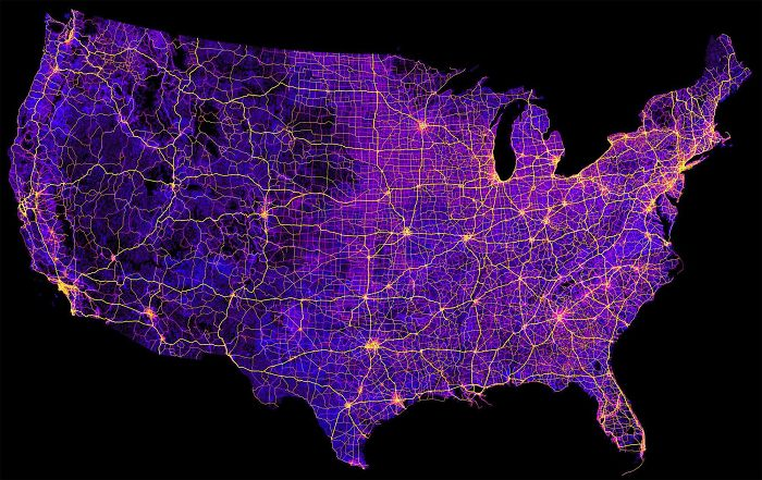
The United States approximately has 8 million miles of combined streets, roads, and highways. It is a very large country that is quite well-connected.
31. Garbage Can vs. Trash Can
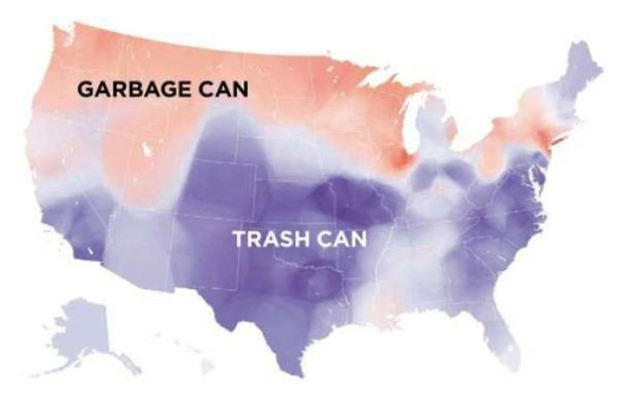
Do you call it a garbage can or a trash can? This map indicates that the term used can change depending on what part of the country you are from.
32. Federal Land
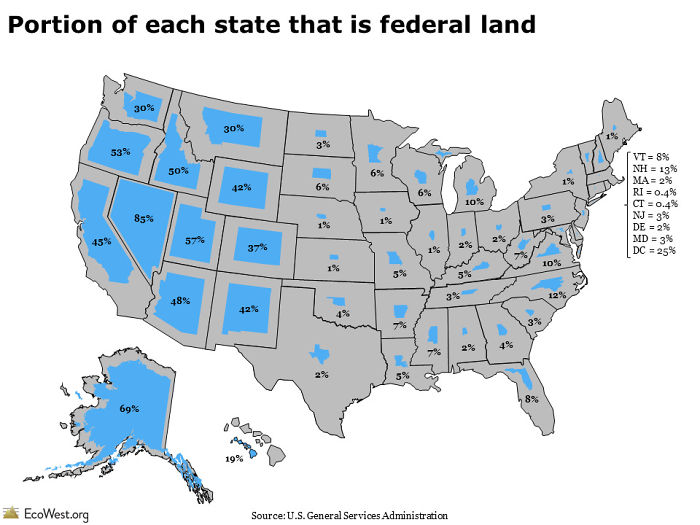
The federal system of government in the United States means that ownership of public property is shared between the federal government and the state government. For some states, the majority of the land is owned by the federal government.
33. Date of Creation Of Counties
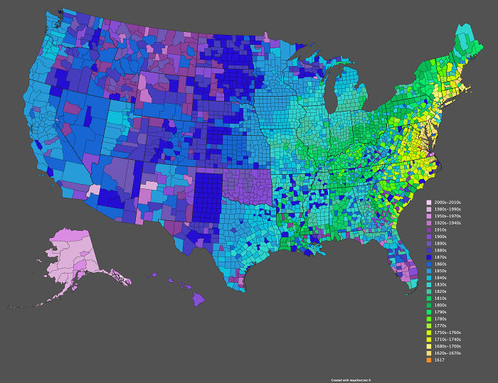
There are a total of 3142 counties in the United States. They were not created at the same time, obviously. The oldest one dates back to 1617, which was before the country’s independence. On the other hand, the latest in the map was created in the previous decade.
Read More: 7 Places to Visit Before You Leave This World
34. Waffle House
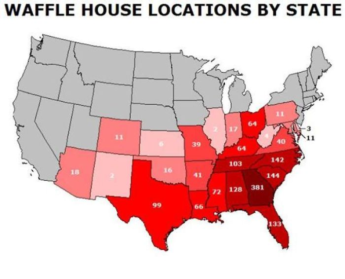
Waffle House is quite a tasty franchise for those on the East Coast. However, it is no more than non-existent on the west coast of the United States.
35. Average Apartment Size
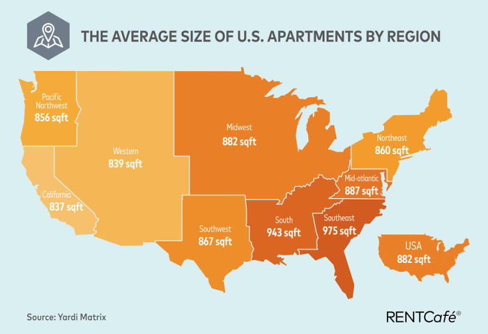
You can now think about whether you are lucky or unlucky with your living situation, depending on where you live. Honestly, anything close to 882 sq. ft. should be fine.
Read More: Bus Driver Buys First Grader New Pajamas So He’s Not Left Out on Pajama Day
This content has, in part, been generated with the aid of an artificial intelligence language model. While we strive for accuracy and quality, please note that the information provided may not be entirely error-free or up-to-date. We recommend independently verifying the content and consulting with professionals for specific advice or information. We do not assume any responsibility or liability for the use or interpretation of this content.