

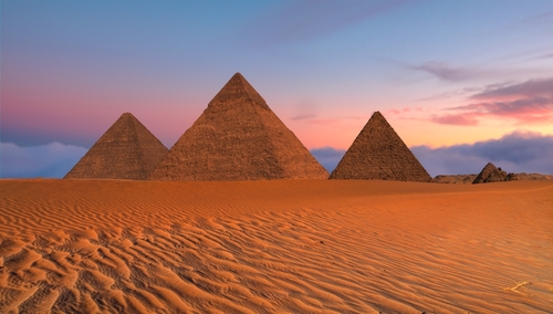
For centuries, the mystery of how Egypt’s mighty pyramids came to be has captivated scientists, historians, and travelers alike. Rising from the desert sands with astonishing precision, the Giza pyramids have long stood as monuments to ancient engineering. Now, new research suggests that a lost branch of the Nile River may have once flowed beside them, offering an essential piece of the puzzle. This discovery could reshape everything we thought we knew about how the pyramids were constructed, and why they were built where they are.
A Hidden Waterway Beneath the Sand
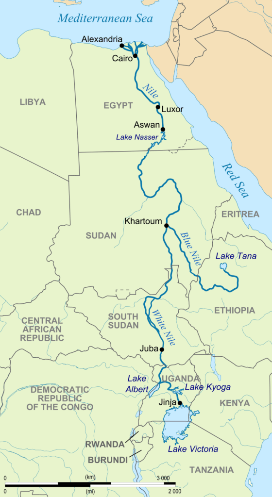
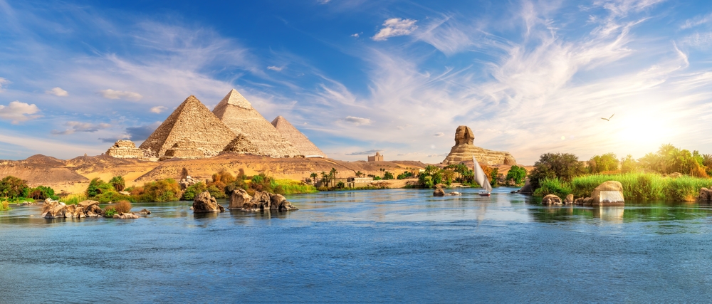
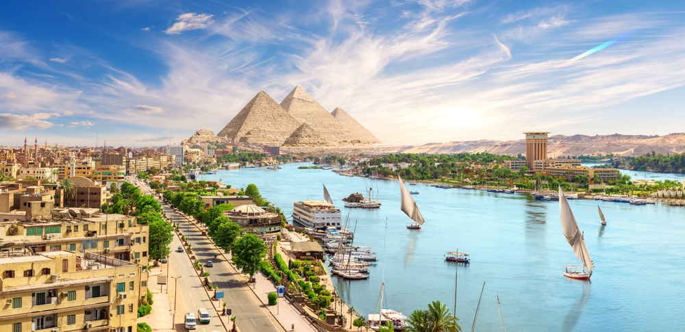
Researchers have uncovered compelling evidence that a long-lost arm of the Nile River, known as the “Ahramat Branch,” once flowed near the Giza Plateau. Using satellite imagery, sediment analysis, and geophysical surveys, scientists traced the course of this hidden river beneath layers of desert sand. Unlike the modern-day Nile, which now lies about 8 kilometers from the pyramids, this ancient branch would have placed the river right beside some of Egypt’s most iconic monuments, including the Great Pyramid of Khufu and the Sphinx. The findings, published in Communications Earth & Environment in 2024, suggest that this vanished waterway was likely active during the time the pyramids were built over 4,000 years ago.
How a River Could Explain the Pyramids’ Placement
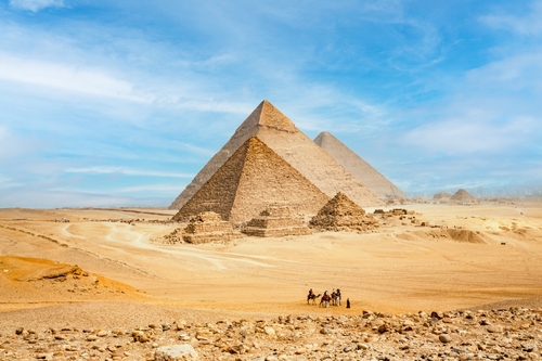
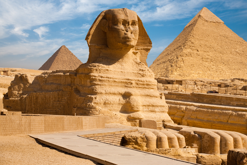
One of the longstanding mysteries in Egyptology is why the pyramids were built where they were. The Giza Plateau, while elevated and ideal for preservation, appears isolated from water sources today. But if the Ahramat Branch once flowed nearby, it changes everything. The presence of a river would have made transporting massive limestone and granite blocks significantly easier. It also explains how such large-scale construction projects could have been supplied with food, water, and labor. River access meant that raw materials and workers could be moved efficiently from other parts of Egypt. This discovery supports ancient records and artwork that depict boats being used in pyramid construction, a detail once debated among scholars.
New Technology Reveals Ancient Secrets
To detect the buried riverbed, scientists combined ground-penetrating radar with satellite data and sediment core samples. What they found was remarkable, a dry but unmistakable riverbed nearly 64 kilometers long, filled with ancient silt and organic material. The study also revealed evidence of old riverbanks, islands, and floodplains. These features suggest the Ahramat Branch was wide and navigable enough to handle large boats during the time of pyramid construction. Notably, many pyramid complexes are aligned along the same path as this river, strengthening the argument that the waterway was central to their construction and daily function.
Could This Shift the Timeline of Egyptian Civilization?
If the Giza pyramids were intentionally built along this river, it may also shift how we understand the development of ancient Egyptian cities and their infrastructure. Civilizations often rise around water sources, and this newly discovered branch of the Nile would have been a vital hub for trade, agriculture, and political control. Moreover, if this waterway remained active longer than previously believed, it could mean that ancient Egypt’s golden age was more closely tied to this hidden river than once assumed. The drying of the Ahramat Branch might have even contributed to the eventual decline of the pyramid-building era.
Pyramids, Boats, and Ancient Canals
Historical accounts from ancient Egypt describe complex systems of canals and boats used to transport materials for pyramid construction. Herodotus, writing in the 5th century BCE, noted that Egyptians used water channels to bring stones to the Giza Plateau. This discovery gives new weight to those stories. It also aligns with archaeological finds such as the Wadi al-Jarf papyri, which describe detailed boat routes used by workers during Khufu’s reign. The idea that the pyramids were constructed using a vast aquatic network is no longer just a theory. This new river evidence provides physical proof that water-based transport was likely a key part of the process.
Why the River Disappeared
The drying of the Ahramat Branch wasn’t sudden, it likely took place over centuries due to climate change, desertification, and shifts in the Nile’s main course. As Egypt’s environment became more arid, this side branch of the river would have slowly vanished beneath sand and silt. By the time of the later dynasties, the Ahramat Branch was no longer viable. This may explain why pyramid construction gradually moved away from the Giza region and declined in scale over time. It’s a powerful reminder that even the mightiest monuments are at the mercy of shifting environments.
What This Means for Future Excavations
With this discovery, archaeologists now have a new geographic feature to guide future digs. Sites once considered too far from the Nile to be significant may now be revisited with fresh perspective. There’s a growing interest in re-mapping ancient Egypt not by today’s geography, but by the waterways that existed thousands of years ago. This could lead to the discovery of long-lost temples, settlements, and infrastructure hidden along the buried river. For modern researchers, it opens an entirely new chapter in understanding how the ancient Egyptians lived, worked, and built their wonders.
Final Thoughts
The idea that Egypt’s Giza pyramids once stood beside a thriving river adds depth to the story of one of humanity’s most iconic achievements. Far from being isolated desert monuments, they may have been the centerpiece of a vibrant, water-connected civilization. This discovery doesn’t just answer an old mystery, it raises new questions. How many more secrets lie buried beneath the desert? What other parts of ancient Egypt have been misinterpreted because we were looking at the modern map? As researchers continue to trace the ancient Nile’s paths and piece together the environmental history of Egypt, one thing is clear, the story of the pyramids is far from finished.
Read More: Uncovering Ancient Secrets: A Hidden Ecosystem Revealed in the Italian Alps