
Most people have a rough idea of what El Niño does. It warms things up. It messes with rain. It makes hurricanes behave differently. Fine. But what’s building in the Pacific right now isn’t the ordinary version of that story. Climate scientists are using a phrase that doesn’t get used often: “super El Niño.” And the more the models run, the less comfortable they look.
The last time the world saw one of these, in 2015 and 2016, entire regions swung from flood to fire within months. Food systems collapsed in places that had never experienced that kind of drought. Coral reefs bleached and died at unprecedented scale. And that was before the baseline temperature of the planet was as high as it is today. The question worth sitting with right now is whether what’s coming will be worse, and whether the world is remotely ready.
The honest answer, in the first week of June 2026, is that scientists can’t yet say with certainty how strong this event will be. What they can say is that the Pacific is behaving in ways that have forecasters paying close attention, and that waiting for certainty before preparing is the wrong call.
What a “Super” El Niño Actually Is

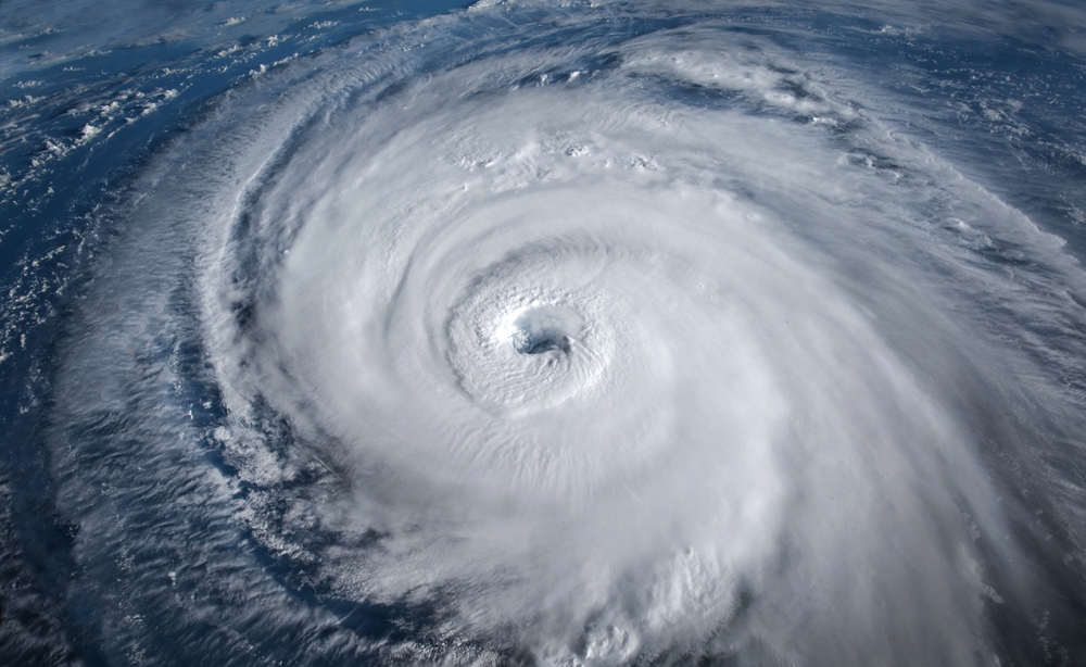
El Niño is a periodic warming of water in the central and eastern equatorial Pacific Ocean that can affect global weather patterns for months. Regular El Niños happen fairly often. There have been 27 El Niños since 1950, with one happening on average every three to four years. A super El Niño is a different category entirely.
The majority of model forecasts now suggest there is at least a 50-50 chance this El Niño could become a “super El Niño,” one in which ocean surface temperatures are at least 2 degrees Celsius warmer than average. To understand why that two-degree threshold changes everything, think of it this way: the ocean isn’t just a temperature reading on a gauge. It’s a massive engine. When it runs hotter than normal, it pumps more energy into the atmosphere, and that extra energy has to go somewhere. It reroutes jet streams, disrupts monsoons, and amplifies drought and flooding simultaneously in different parts of the world.
There are only three super El Niños on record: from 1982 to 83, 1997 to 98 and 2015 to 16. Those three events left a clear record of what a warming Pacific can do to a planet that is already running warm.
What the Signals Look Like Right Now

The latest monthly Global Seasonal Climate Update from the World Meteorological Organization signals a clear shift in the equatorial Pacific: sea-surface temperatures are rising rapidly, pointing to a likely return of El Niño conditions as early as May to July 2026.
“After a period of neutral conditions at the start of the year, climate models are now strongly aligned, and there is high confidence in the onset of El Niño, followed by further intensification in the months that follow,” said Wilfran Moufouma Okia, Chief of Climate Prediction at WMO.
The mechanism behind this rapid warming is worth understanding because it explains why forecasters are increasingly uneasy. Normally, the Pacific trade winds blow from east to west along the equator, pushing warm water toward Asia. But in April 2026, a pair of cyclones straddling the equator caused the wind direction to reverse. This short-lived reversal triggered a downwelling Kelvin wave, a pulse of energy beneath the ocean surface moving eastward along the equator, and that subsurface pulse has now reached the eastern Pacific, fueling intense warming off South America.
Paul Roundy, a University of Albany professor and El Niño expert, wrote that “confidence is clearly shifting higher on potentially the biggest El Niño event since the 1870s.”
That said, forecasters are careful to note what they don’t yet know. The current forecasts for 2026 to 2027 still span a wide range, from expecting weak to strong El Niño conditions. How the winds behave in the coming weeks will determine what develops. If trade winds weaken again at the right moment, it could tip the system into self-sustaining warming, the kind that’s hard to stop. The Pacific has loaded the dice. Whether it rolls a six is still being decided.
What History Tells Us Will Happen
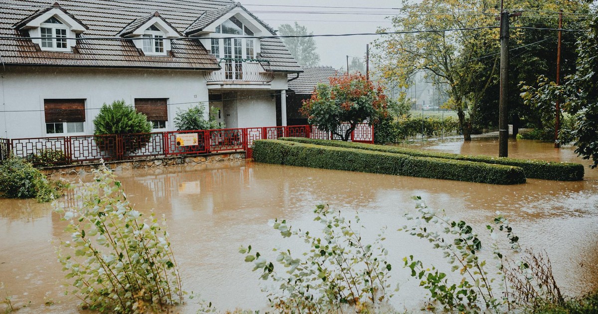
The 2015 to 2016 super El Niño is the closest template for what a strong event looks like at scale. According to NOAA, that event was connected to a record-breaking hurricane season in the central North Pacific, water shortage in Puerto Rico, drought in Ethiopia, and the hottest global surface temperature on record at that time.
The humanitarian toll was severe. The El Niño event of 2015 to 2016 severely affected more than 60 million people worldwide with droughts and heavy rainfall. Several African countries declared a national state of emergency. In southern Africa, food for more than 40 million people was at risk. Ethiopia experienced its worst drought in 50 years, with 10 million people dependent on food aid. In Haiti, drought cut crop yields in half.
The economic damage was equally severe. Analysts estimated the global economy would have been $3.9 trillion larger over the three years following 2015 to 2016 had that El Niño not occurred.
All three super El Niños on record contributed to regime shifts in regional ocean temperatures, leading to unprecedented marine heat waves that destroyed or damaged coral reefs and caused mass die-offs among many marine organisms, from starfish to seabirds. Those impacts persisted for years and could shift some regional patterns for decades.
The Climate Change Multiplier
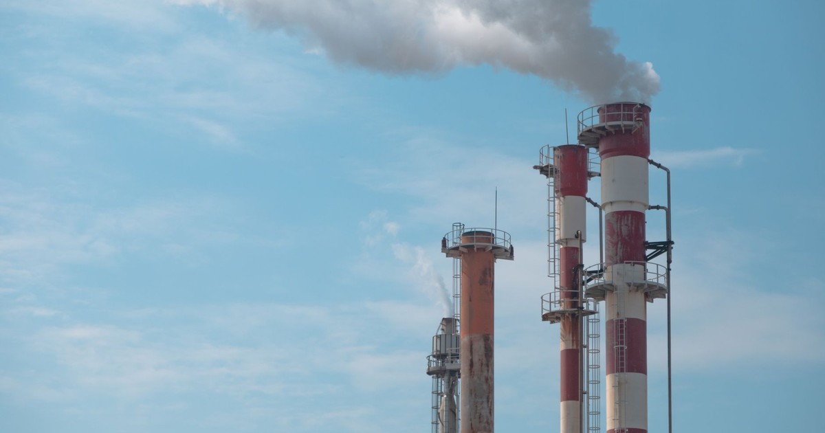
El Niños release heat stored in the ocean back into the atmosphere, which causes global average surface temperatures to rise. A strong El Niño, coupled with rising temperatures due to climate change, could set new global temperature records in 2026 or 2027.
The background temperature against which this event will play out is already higher than anything previous super El Niños faced. The year 2024 was the hottest year on record, with global average temperatures more than 1.5°C above the 1850 to 1900 average. The past 10 years, from 2015 to 2024, were the hottest decade on record globally.
A December 2025 study in Nature Communications found that super El Niño events significantly increase the likelihood of “climate regime shifts,” meaning sudden and persistent changes in regional climate systems, including temperature, sea surface conditions, and soil moisture, that can endure for years or even decades after the El Niño itself has faded. Under global warming scenarios, the study found this effect would be “greatly amplified,” with the central North Pacific, the Gulf of Mexico, East Africa, the Amazon, and central Australia among the regions most at risk. The implication is that the effects of a 2026 super El Niño may not simply reverse when Pacific temperatures cool again. Some changes could lock in.
The U.S. is already seeing what this looks like on the ground. The heat wave that gripped the southwest half of the United States in late March 2026 has been named one of the top meteorologically stunning extreme events of the century. Many locations set both all-time high temperatures for the month of March and their earliest 100-degree temperature on record. That happened before the El Niño even formally arrived.
What a Super El Niño Means Region by Region
How this event hits depends on where you live. When ocean heat spreads across the equatorial Pacific, it spills into the atmosphere in pulses that tilt weather patterns, reroute high-elevation winds, raise global temperatures, bleach coral reefs, and disrupt fisheries. The effects reach every inhabited continent, intensifying rainstorms and flooding in some regions while amplifying extreme heat, drought, and wildfires in others.
Jet streams shift southward during a super El Niño, altering storm tracks across North America, South America, and beyond. Some regions get drenched while others bake dry. Parts of Southeast Asia and Australia may experience drought, while areas like Peru and Ecuador can face intense rainfall and flooding.
For North America specifically, California and the western U.S. tend to see increased winter precipitation during strong El Niños, including the kind of atmospheric river storms that can cause catastrophic flooding in areas that were in drought conditions just weeks earlier. The Southeast and Gulf Coast often run warmer and drier. Meanwhile, for the May to July season, land surface temperatures are expected to be above normal nearly everywhere, with the signal especially strong over southern North America, Central America, and the Caribbean, as well as Europe and Northern Africa.
The Atlantic hurricane season, by contrast, may actually see fewer storms. During summer, El Niño’s warm water fuels hurricanes in the central and eastern Pacific, while it tends to hinder hurricane formation in the Atlantic Basin. According to NOAA’s 2026 Atlantic hurricane season outlook, forecasters are predicting 8 to 14 named storms, three to six hurricanes, and one to three major hurricanes. But fewer storms doesn’t mean safe. A below-average season can still produce one catastrophic storm, and complacency in a slow year has cost lives before.
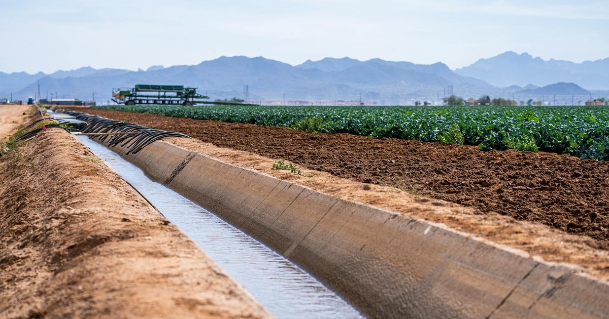
The food system is another dimension that rarely makes it into weather headlines. Super El Niño disrupts rainfall and monsoon systems, lowering staple crop yields and increasing food prices. U.S. maize, Brazilian soybeans, and Southeast Asian rice were all affected during previous events. Supply chain disruptions follow crop failures, and the effects ripple into grocery prices months after the extreme weather has passed.
Super El Niño Preparation: What You Can Actually Do

The gap between “scientists are worried” and “here is what I do on Tuesday” is where most people get stuck. Super El Niño preparation doesn’t require a bunker or a year’s supply of freeze-dried food. It requires doing a set of practical things now, before the weather turns, rather than during it.
The most consistent advice from disaster preparedness researchers comes down to three categories: information, supplies, and community. The first six months of 2025 alone marked the U.S.’s costliest first half of a year for major disasters, racking up $101 billion in damages. One study published in Nature estimated that a person’s risk of experiencing climate hazards has doubled since 1960. Those numbers make preparation a practical calculation, not a catastrophist hobby.
On the information side, know which specific hazards are most likely in your region. Flooding in the Southeast and Pacific Coast. Drought and wildfire risk in the interior West. Extreme heat nearly everywhere. The Federal Emergency Management Agency has an app for both iPhone and Android that sends location-specific weather warnings and preparation checklists, nearby shelter locations, disaster resources, and evacuation notices.
On the supplies side, the recommendations from climate adaptation researchers are more specific than most people realize. If you live in an area with hazards that could require evacuation, having a go bag is important. It should include lists of medications, copies of important documents, and items you can quickly load into your car under the stress of a real emergency. If there’s an extreme event, you may not get to refill a prescribed medication, but if you have a monthly prescription, you can usually refill it with your insurer up to a week in advance.
For your home, think ahead about your specific vulnerabilities. If you own your home, investing in upgraded insulation, alternative energy sources like solar, and impact-resistant doors, windows, and roofs makes the structure itself more resilient. Before any disaster, photograph and document your possessions. Taking photos and videos of your home and belongings before an emergency will make it significantly easier to process insurance claims afterward.
Community is the piece most people skip entirely. Being mindful of who is around you, building community, and using shared knowledge to support each other through disasters is one of the most effective forms of preparation a person can make. Know which neighbors are elderly, which households have small children, and who might need help getting out quickly. That kind of network is worth more than any amount of stockpiled water once an emergency actually arrives.
What to Do With the Uncertainty

The scientists who study El Niño most closely will tell you something that doesn’t always make it into the alarming headlines: certainty about this event’s final strength won’t arrive until late summer 2026. Forecasting El Niño is not like predicting next week’s weather. Forecasts typically aren’t reliable before late spring, not because scientists don’t understand the system, but because we understand its limits.
The uncertainty is real, but it doesn’t cancel out the preparation. Think of it this way: if a strong El Niño materializes and you haven’t prepared, the consequences arrive fast and they don’t wait. If it ends up weaker than feared and you’ve already assembled an emergency kit, documented your home, downloaded the FEMA app, and had a conversation with your neighbors about an evacuation plan, you’ve lost nothing. You’ve actually gained something: the low-grade background stress of knowing you’re not ready for anything simply goes away.
The previous super El Niño crushed global temperature records in 2015 and 2016. Those two years remain among the top 10 warmest years for the planet, all of which have occurred since 2015. The one that may be forming now doesn’t get to start from that baseline. It starts from where we are now, which is already hotter. That’s not a reason to spiral. It is a reason to treat super El Niño preparation as something you do this month, rather than something you get to later.
The Part No One Wants to Say Out Loud
Here is what separates this moment from previous El Niño cycles: the planet has no lower floor to return to. Every time the climate oscillates back toward “normal,” that normal is warmer than the one before it. A super El Niño in 2026 doesn’t just add a temporary spike on top of a stable line. It adds a spike on top of a line that is already moving upward. When the event fades, as all El Niños eventually do, the baseline it leaves behind will be higher than the one it started from.
The preparations described above, from the go bag and the insurance documentation to the conversation with your neighbor about who needs help evacuating, are not dramatic acts. They’re the kind of ordinary, doable things that make the difference between a hard situation and an unmanageable one. Most people who have lived through a major weather disaster will tell you the same thing: the people who fared best were not the ones who saw it coming on the news. They were the ones who had already decided what they would do.
AI Disclaimer: This article was created with the assistance of AI tools and reviewed by a human editor.